

 Español
 한국어
 Русский
 हिन्दी
 Português
 Türkçe
 Tiếng Việt
 Italiano
 Français
 日本語

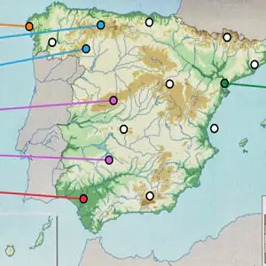
Physical Map of Spain: Interactive Relief
About Physical Map of Spain
This physical map of Spain interactive turns the relief syllabus into a label-placing challenge: instead of memorizing a list, you have to place each landform at its exact spot on the map. The map includes mountain systems, mountain ranges, depressions, mountains, capes and gulfs, all on a relief map of Spain with an altitude legend. It's a very visual way to prepare for a Natural and Social Science or Geography exam, and if you like it, you'll find many more similar challenges in our geography games.
The key to the map is in the colors: the brown shades mark the highest areas (mountains and mountain ranges) and the greens the lowest, such as the depressions of the great rivers and the coasts. Reading that legend correctly already gives you half the answer.
How do you play the physical map of Spain?
The map shows several marked points and, next to it, a list of names. Your mission is to take each name to its correct point. When you finish, the game checks your answers and shows you how many you got right.
- Look at the map and locate the points you need to label.
- Read the available names and think about whether they're mountains, depressions or coastal features.
- Drag each label to its point.
- Check the result and play again to beat your score.
Physical Map of Spain controls
PC
- Mouse (click and drag): move each name to its place on the map
Mobile and tablet
- Tap and drag: place the labels on the points
What do you learn in Physical Map of Spain?
- Locate the major units of the relief of Spain: the Central Plateau, the mountain ranges around it and the outer ranges.
- Tell apart mountain, depression, cape and gulf based on their shape and position.
- Interpret the altitude legend of a physical map.
- Relate relief to rivers: the Ebro and Guadalquivir depressions are river valleys.
Recommended from age 9, ideal for the last years of primary school and the first years of secondary school.
Tips for playing better: Physical Map of Spain
- Start with the edges: the Pyrenees mark the border with France and the Cantabrian Mountains runs along the north coast; they're easy to recognize.
- For the south, remember that Sierra Morena separates the Plateau from the Guadalquivir valley, and the Baetic Systems (with Sierra Nevada) lie further to the southeast.
- Coastal labels are easier if you think in terms of corners: a cape sticks out into the sea and a gulf is a wide inlet of the sea into the land.
- When you get one wrong, don't just forget the mistake: note which point was the right one and try again right away.
Physical Map of Spain FAQ
Does it work as a relief map of Spain to fill in?
Yes. It works like the classic fill-in worksheet, but with automatic correction: you drag the names instead of writing them and you know right away whether you got it right.
What's the difference between the physical map of Spain and the political map?
The physical map shows relief, rivers and coasts; the political map shows autonomous communities, provinces and capitals. This game focuses only on relief.
Is it one of the interactive maps of Spain you can use in class?
Yes. It's played in the browser without installing anything, so it works on the interactive whiteboard, on the classroom computer or on tablets for reviewing in pairs.
Additional information: Physical Map of Spain
Game type: Educational, geography, interactive map
Recommended age: Ages 9 and up
Technology: HTML5
Platform: Web browser (PC, tablet and mobile)
Enjoyed Physical Map of Spain? Also try rivers of spain, Map of the Autonomous Communities of Spain or Europe Map Game. Find more Geography Games and hundreds of free online games on LudoRex.
🏷 Geography Games, Educational games for kids aged 11 to 12, Educational Games for Kids Aged 9 to 10, Educational Games for Kids
Last update:
Games like Physical Map of Spain
View all › Map of the Autonomous Communities of Spain: game
 Map of the Rivers of Spain: interactive game
 Europe Map Game: put every country in its place
 Asian Flags: a Game for Learning Countries
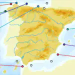 Capes and Gulfs of Spain: Interactive Map
 World Countries Word Search
 Departments and Capitals of Colombia for Kids
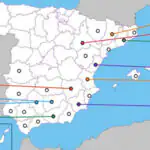 Spain Provinces Map Game: South and East
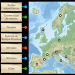 Blank physical map of Europe: interactive game
 NEW WorldGuessr: find out where in the world you are
 Multiplication Duck
 PACMAN Multiplication Tables
 Tangram Online: Geometric Shapes Puzzle
 Handwriting Exercises Online: Letters and Numbers
 Oxytone, Paroxytone, and Proparoxytone Words: Sort Them
 Morse Code: Crack the Secret Word
 Dinosaurs to Color Online: paint and save
 Pixel Art: Copy Pixelated Drawings on Your Grid